Al hacer clic en Cerrar, usted acepta el uso de cookies en nuestro sitio web. Si no está de acuerdo, puede ajustar la configuración de su navegador o abandonar nuestro sitio web.


OUR EQUIPMENT

At High Line Division Unmanned Systems, we have all the necessary tools to operate in all operational categories and with a wide variety of drones that allow us to carry out the most varied operations, from technical inspections to emergency operations, security and surveillance, multimedia productions, photogrammetry and more…


OUR EQUIPMENT

In order to be able to carry out a wide range of specific missions safely, efficiently and professional, at High Line Division Unmanned Systems we have equipped ourselves with a comprehensive range of equipment to ensure we meet this objective.

Below, we will provide a brief overview of some of our tools, which enable us to carry out highly demanding missions that require very high standards of safety and quality, depending on their operational category and business objectives.

STANDARD SCENARIO STS-01

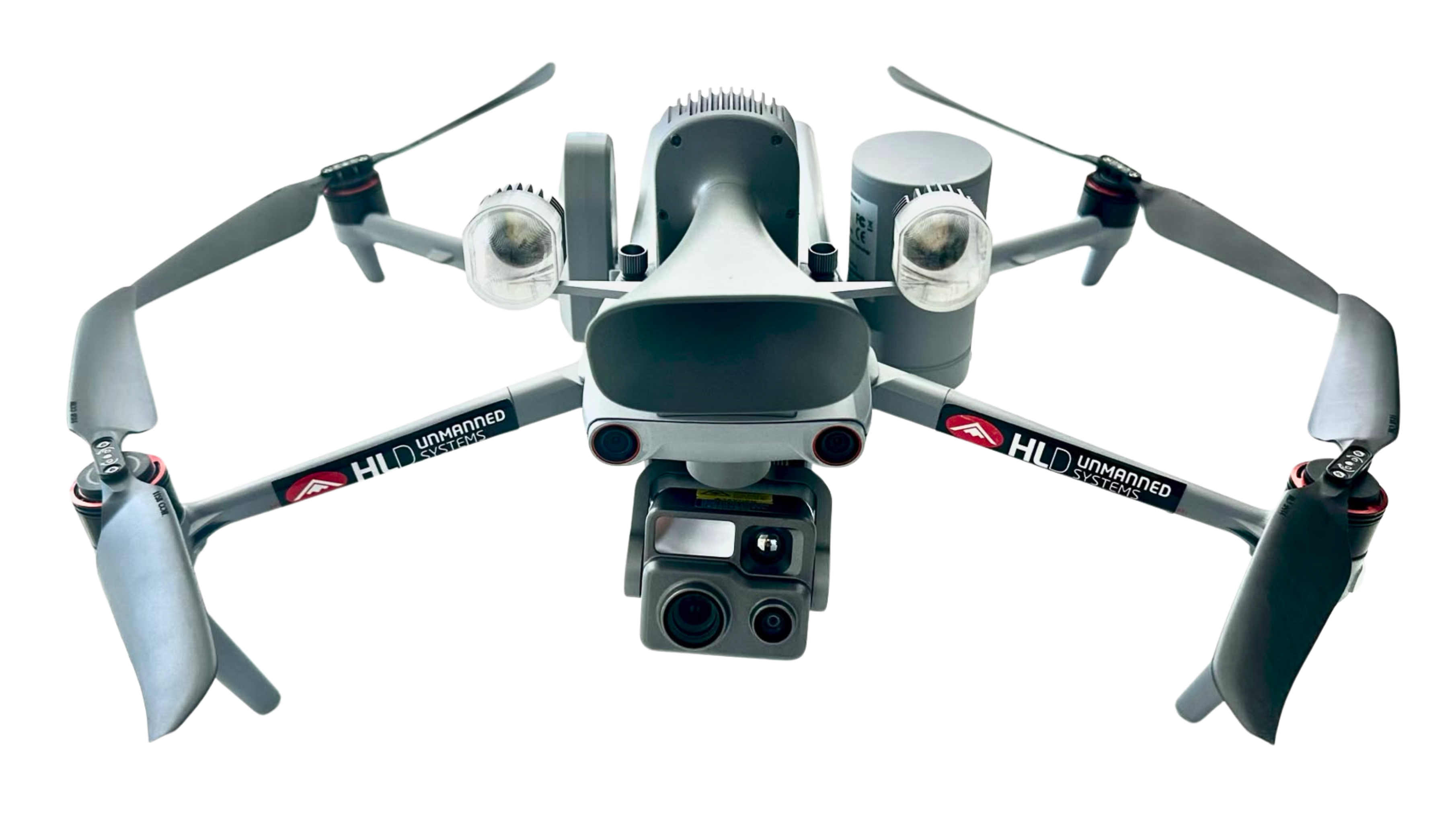
AUTEL EVO MAX 4T XE

The Autel EVO Max 4T XE, classified as C5 marking class (C5 Conversion Kit – FTS + Parachute), is an advanced aerial platform designed for professional missions in complex urban environments. Thanks to its C5 certification, this system is ready for specific operations in accordance with the European regulatory framework STS-01, facilitating urban flights under advanced operational scenarios and SORA risk assessments. Its combination of smart sensors, thermal capabilities and redundant systems makes it an ideal tool for public safety, infrastructure inspection, emergency response and technical surveillance, even in environments with GNSS denial-of-service.

Main technical specifications:

   Maximum take-off weight: 1,999 g
   Operating frequencies: 2.4, 5.1 and 5.8 GHz
   Maximum flight altitude: 4,000 m
   Wind resistance: 12 m/s
   Maximum flight time: 42 minutes
   IP rating: IP43
   GNSS: GPS, GLONASS, BeiDou, Galileo
   Temperature range: -20 to 50°C
   Class marking: C5
   Accessories: Speaker and night light

STANDARD SCENARIO STS-02

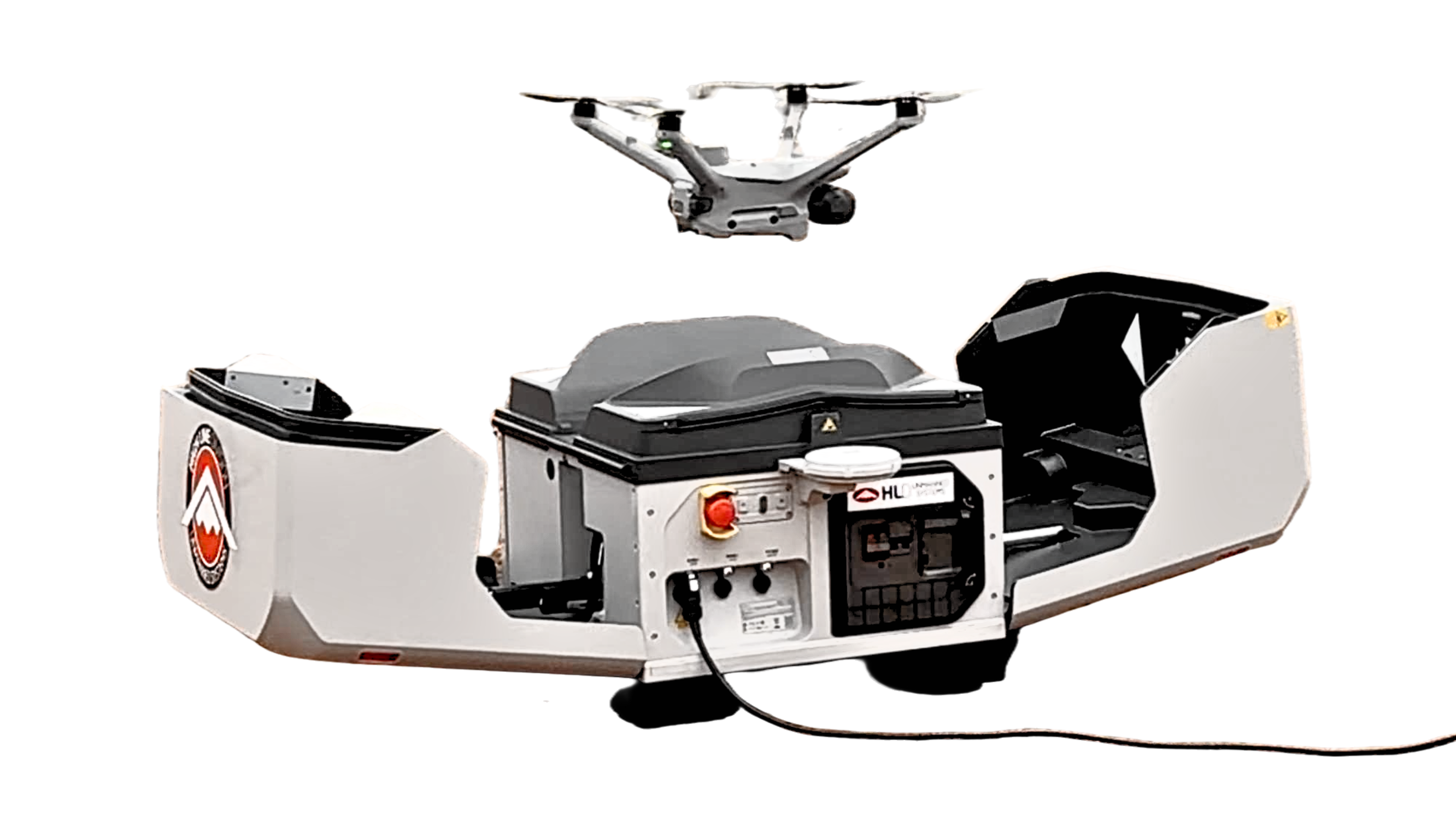
DJI MATRICE 4TD + DJI DOCK 3

The system formed by the DJI Matrice 4TD and DJI Dock 3, equipped with C6 marking class, represents an advanced solution for automated operations and BVLOS (Beyond Visual Line of Sight) flights within the European STS-02 standard scenario. Designed for technical inspection, surveillance or patrol missions and infrastructure monitoring, this ecosystem combines a state-of-the-art multi-sensor aircraft with an autonomous station capable of carrying out remote deployments 24 hours a day, whilst also enabling linear inspection integrated into our mobile units.

The DJI Dock 3 enables the deployment, landing, recharging and remote management of the aircraft without the need for permanent on-site personnel. Its industrial design with IP56 protection, resistance to extreme temperatures and continuous operation capability make it a solution particularly suited to permanent installations at critical infrastructure sites such as industrial parks, energy networks and logistics centres.

Main technical specifications:

   Maximum take-off weight: 2,090 g
   Dock weight: 55 kg
   Operating frequency: 2.4, 5.1 and 5.8 GHz
   Maximum flight altitude: 6,500 m
   Wind resistance: 12 m/s
   Maximum flight time: 47 minutes
   IP rating: IP55 (Drone); IP56 (Dock)
   GNSS: GPS, GLONASS, QZSS, BeiDou, Galileo
   Temperature: −20 to 50 °C (Drone); −30 to 50 °C (Dock)
   Class marking: C2 – C6 (with DJI Dock 3)

OPEN CATEGORY A3

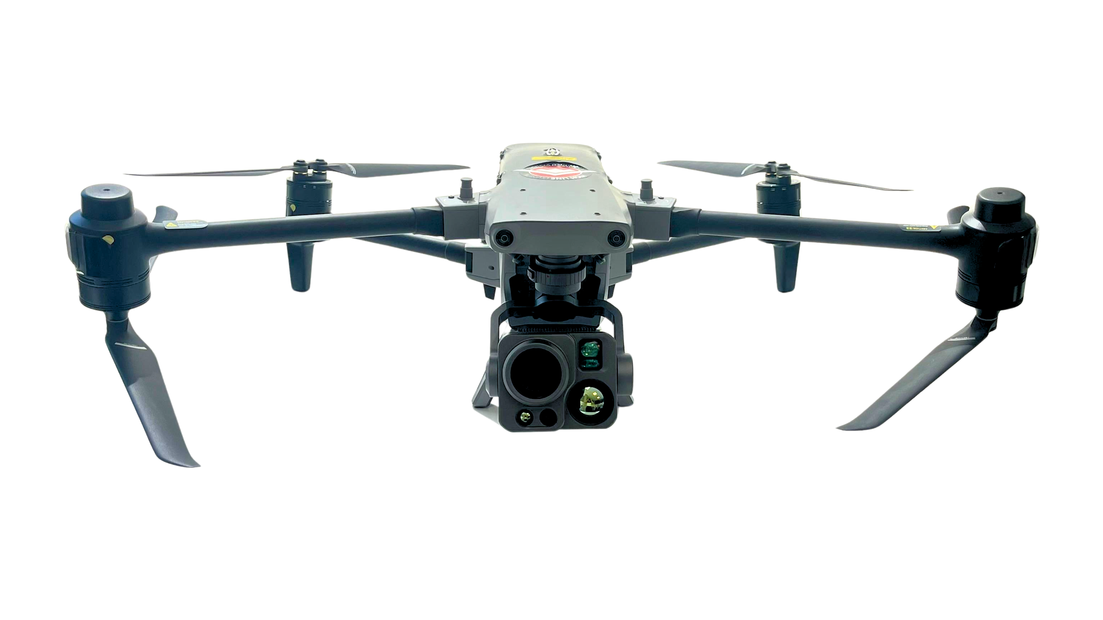
AUTEL ALPHA

The Autel Alpha, classified as C3 marking class, is a professional aerial platform developed for critical public safety missions, industrial inspection, emergency response and infrastructure monitoring. Its robust design, combined with advanced detection systems, a multi-sensor payload and IP55 industrial-grade environmental resistance, makes it a solution particularly suited to organisations requiring maximum reliability in complex operational environments.

Equipped with the DG-L35T payload system, the Autel Alpha integrates high-resolution visual cameras, a long-range optical zoom with up to 560x hybrid zoom, professional thermal sensors and advanced remote observation capabilities. It incorporates a comprehensive perception system based on visual sensors and 60 GHz millimetre-wave radars capable of detecting obstacles in all six directions. This technology enables thermal analysis of electrical installations by identifying cables, structures, vegetation and other hard-to-detect elements; and allows for detailed inspections, perimeter surveillance, and AI-powered tracking and detection of people, vehicles, boats and animals.

Main technical specifications:

   Maximum take-off weight: 8.4 kg
   Operating frequencies: 900 MHz, 2.4, 5.2 and 5.8 GHz
   Maximum flight altitude: 800 m
   Wind resistance: 12 m/s
   Maximum flight time: 40 minutes
   IP rating: IP55
   GNSS: GPS, GLONASS, BeiDou, Galileo
   Temperature: -20°C to 50°C
   Class rating: C3

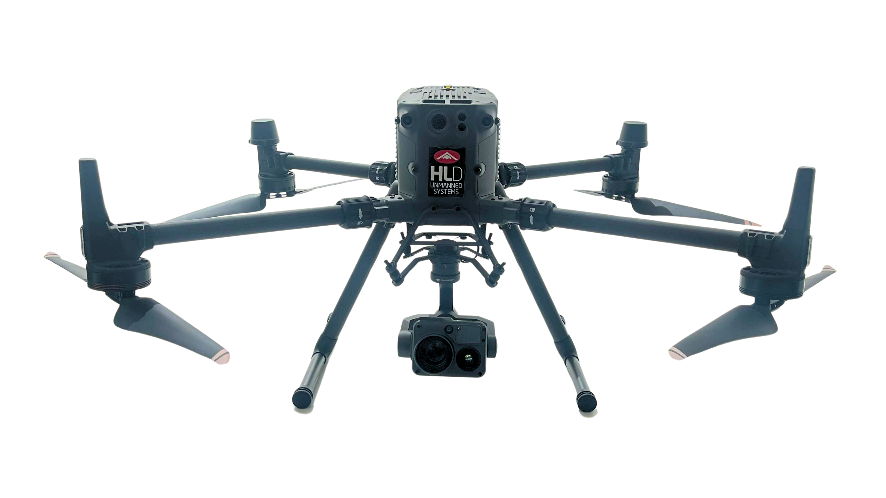
DJI MATRICE 350RTK

The DJI Matrice 350 RTK, equipped with the DJI Zenmuse H20T, is one of the most versatile and established aerial solutions on the professional market, offering the option to swap gimbals or use dual-camera mode by installing multiple cameras. This system is designed for industrial inspection, public safety, emergency response, energy, infrastructure and technical surveillance missions, combining a robust aerial platform with a multi-sensor payload capable of providing visual, thermal and metric data in real time.

It features a long flight time, a robust transmission system, omnidirectional obstacle detection, IP55 rating, hot-swappable batteries, customised payloads for RGB and thermal inspection, LiDAR and audiovisual productions, as well as real-time centimetre-level positioning via the RTK system.

It offers excellent resistance to adverse weather conditions and, thanks to its interchangeable gimbal, can be used for technical inspections, photogrammetry, topographic surveying, surveillance, or search and rescue operations.

Main technical specifications:

   Maximum take-off weight: 9.2 kg
   Operating frequencies: 2.4, 5.1 and 5.8 GHz
   Maximum flight altitude: 7000 m
   Wind resistance: 12 m/s
   Maximum flight time: 55 minutes
   IP rating: IP55
   GNSS: GPS, GLONASS, BeiDou, Galileo
   Temperature: -20 to 50°C
   Class rating: C3

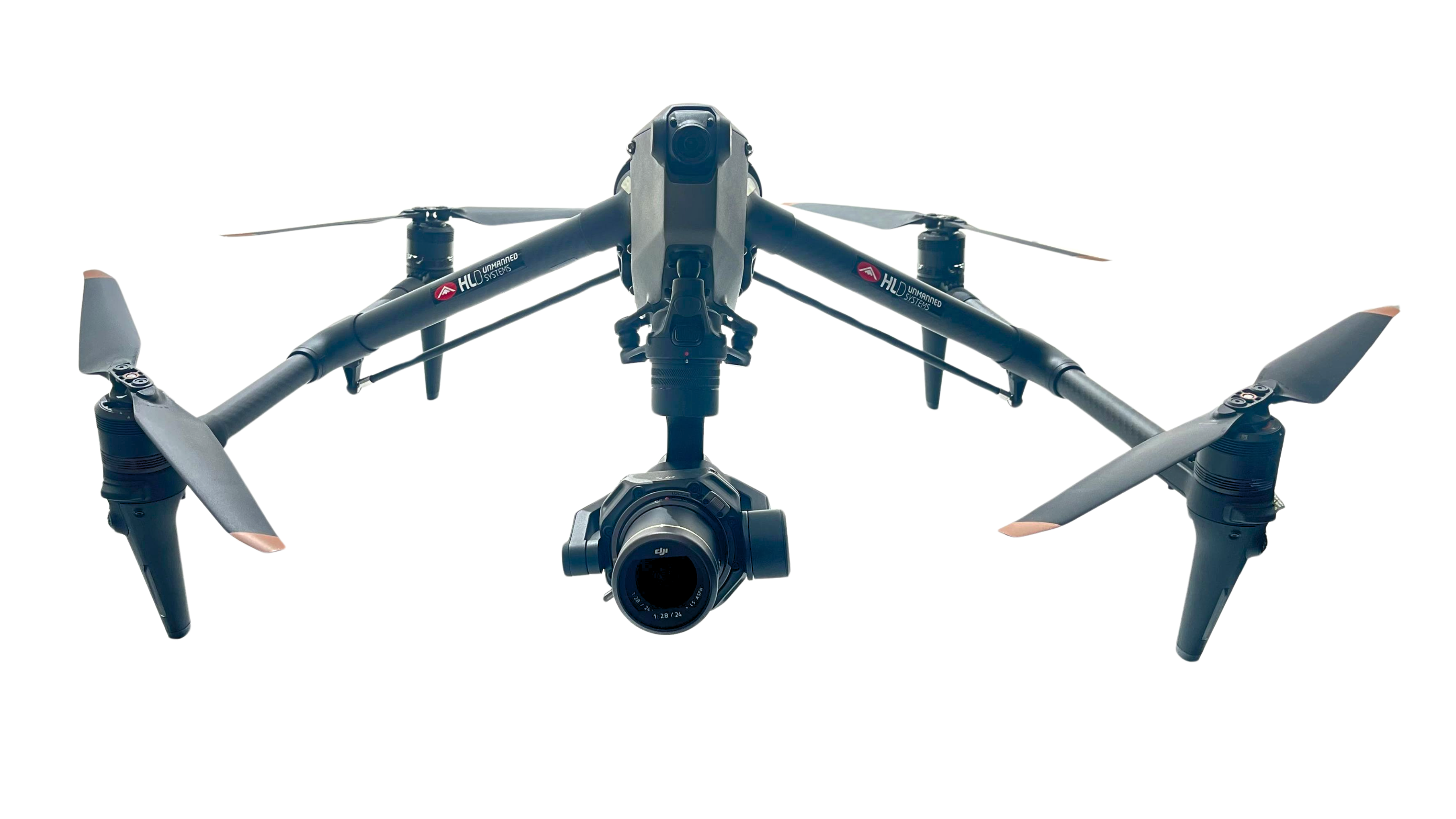
DJI INSPIRE 3

The DJI Inspire 3 represents the pinnacle of professional aerial cinematography, combining a precision aerial platform with a full-frame imaging system capable of capturing cinematic video in 8K resolution using the 24mm Zenmuse X9-8K Air camera. Its design, performance and workflow make it an ideal tool for multimedia productions and audiovisual projects.

Timecode synchronisation, compatibility with digital cinema production standards and recording in RAW formats make this platform a tool perfectly suited to the requirements of the modern audiovisual industry.

Furthermore, its maximum speed has been increased to 10 m/s, and it features centimetre-level positioning via an RTK module, omnidirectional obstacle detection and hot-swappable batteries.

Main technical specifications:

   Maximum take-off weight: 4.31 kg
   Operating frequencies: 2.4, 5.1 and 5.8 GHz
   Maximum flight altitude: 7,000 m
   Wind resistance: 12 m/s
   Maximum flight time: 25 minutes
   GNSS: GPS, BeiDou and Galileo
   Temperature: -20 to 40°C
   Class marking: C3

OPEN CATEGORY A2

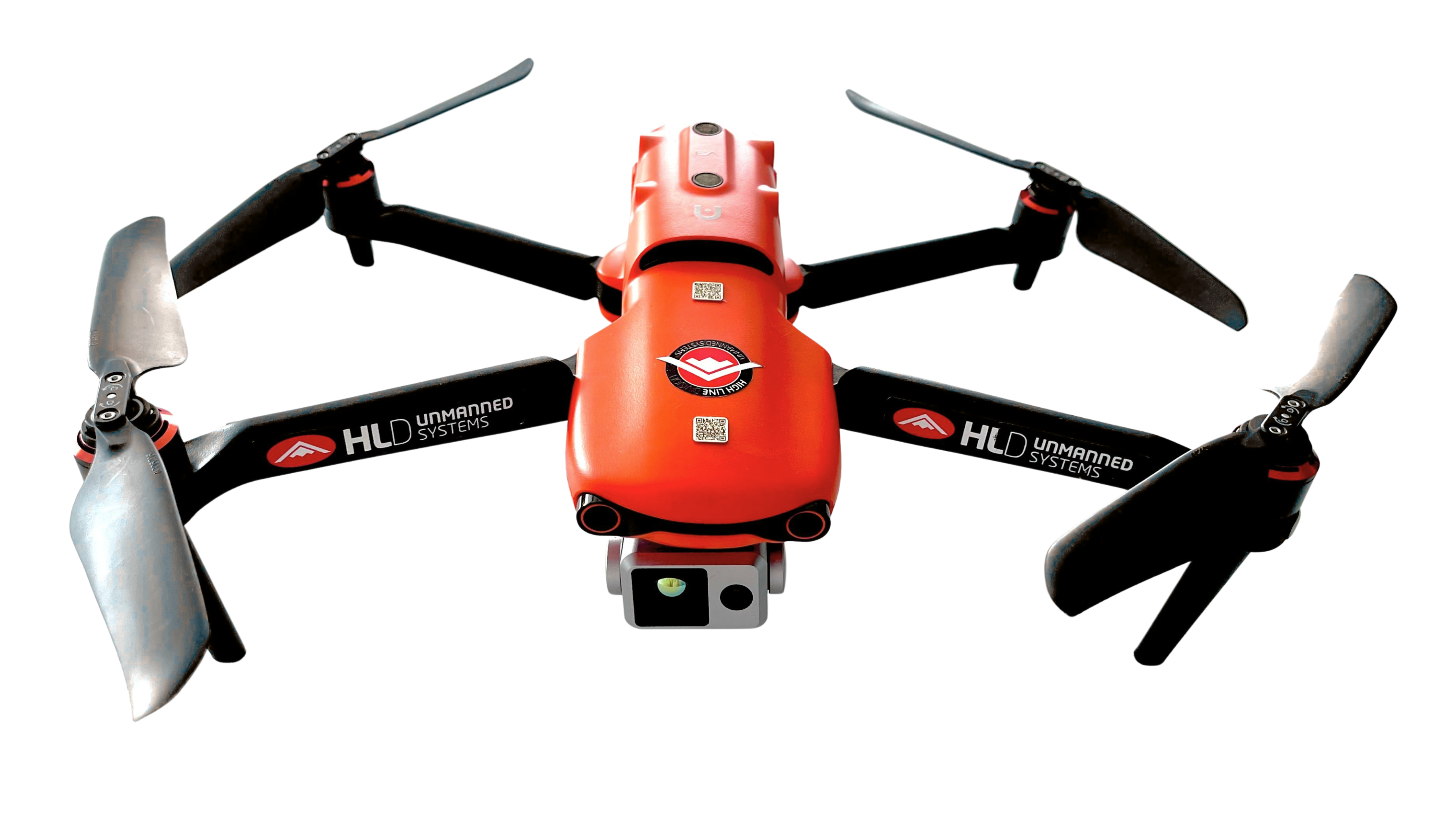
AUTEL EVO II DUAL 640T V3

The Autel EVO II Dual 640T V3 has been developed for professionals who need to obtain high-precision visual and thermal data across a wide range of operational scenarios. Its combination of thermal and optical sensors, together with a compact and easy-to-deploy platform, makes it an ideal solution for technical inspections, industrial maintenance, public safety and emergency management.

This system integrates a high-resolution radiometric thermal camera and a high-quality visual camera, allowing simultaneous analysis of thermal data and conventional imagery. Thanks to this combination, operators can locate anomalies, identify energy losses, detect overheating and monitor installations in great detail.

Main technical specifications:

   Maximum take-off weight: 1,270 g
   Operating frequencies: 900 MHz, 2.4, 5.2 and 5.8 GHz
   Maximum flight altitude: 800 m
   Wind resistance: 12 m/s
   IP rating: IP43
   Maximum flight time: 38 minutes
   GNSS: GPS, BeiDou and Galileo
   Temperature: -10 to 40°C
   Class marking: C2

OPEN CATEGORY A1

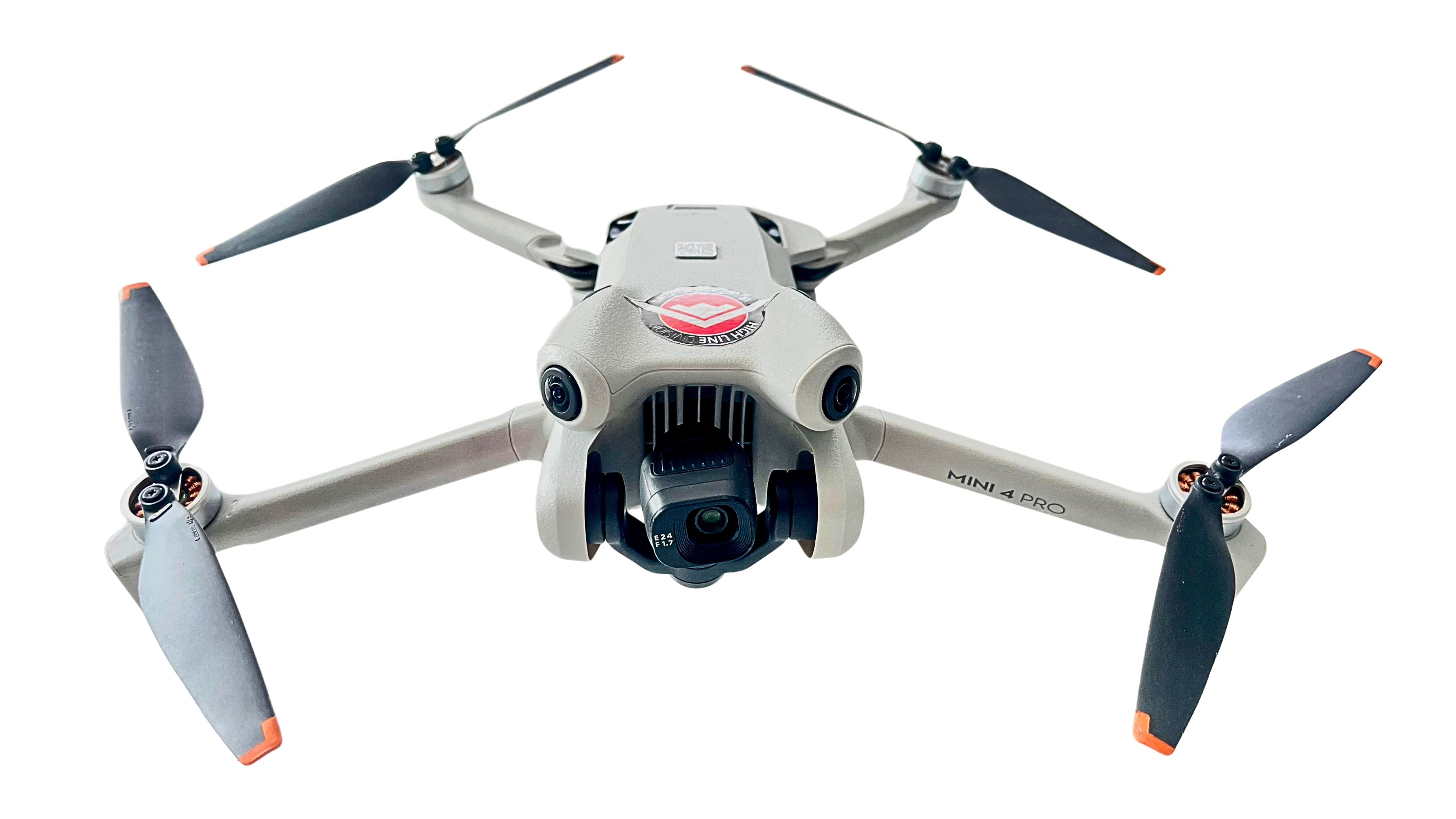
DJI MINI 4 PRO

The DJI Mini 4 Pro thanks to its compact size, offers great flexibility for working in urban environments, with its C0 marking class and weight of less than 250g; its ability to fly as close to buildings as is necessary and safe also streamlines operations and coordination in urban settings. Furthermore, its ability to capture 4K photos and video in both landscape and portrait formats provides added flexibility when creating content for social media.

Main technical specifications:

   Maximum take-off weight: 249 g
   Operating frequencies: 2.4, 5.1 and 5.8 GHz
   Wind resistance: 10.7 m/s
   Maximum flight time: 34 minutes
   GNSS: GPS, BeiDou, Galileo
   Temperature: -10 to 40°C
   Class marking: C0

OTHER EQUIPMENT

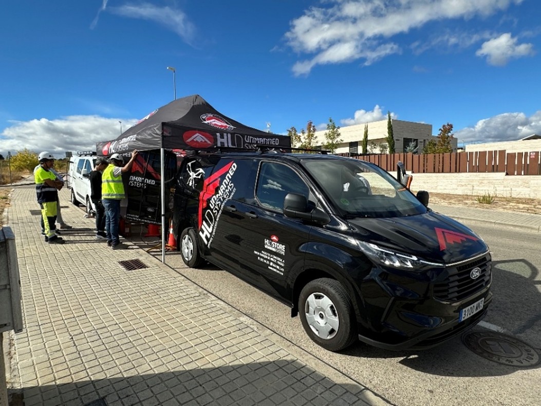
MOBILE DRONE COMMAND CENTER

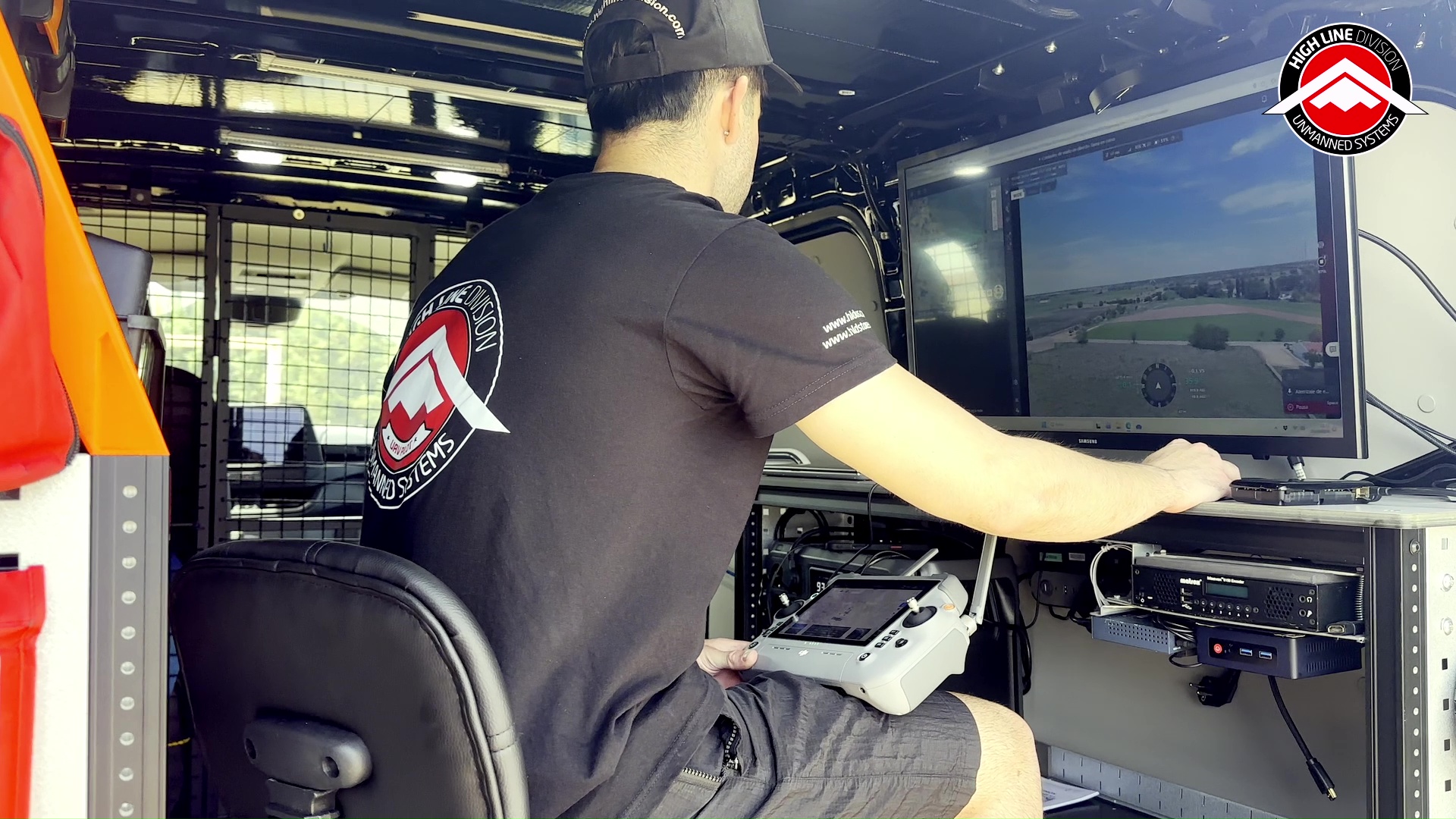
In order to carry out our drone operations for capturing all types of data beyond visual line of sight from a moving vehicle – the cornerstone of our efficiency in inspecting linear infrastructure, which has enabled us to inspect and scan tens of thousands of kilometres of power lines in Spain and abroad, at HLDUS we have developed our Advanced Drone Command Centres.

To this end, we have 4x4 all-wheel-drive vehicles that allow our professionals to venture into the most demanding environments, be it the desert or forest tracks. These vehicles also feature ergonomic, customised workstations inside so that both the pilot and the camera operator can work safely and effectively whilst the vehicle is in motion.

Thanks to this tool, we can carry out rapid deployments and optimise aircraft flight times, making it particularly useful for technical inspections of linear infrastructure and for security, surveillance and search-and-rescue missions, as well as for live streaming of drone images, which enables rapid and effective detection and visualisation.

HANDHELD GIMBALS & ASSORTED CAMERAS

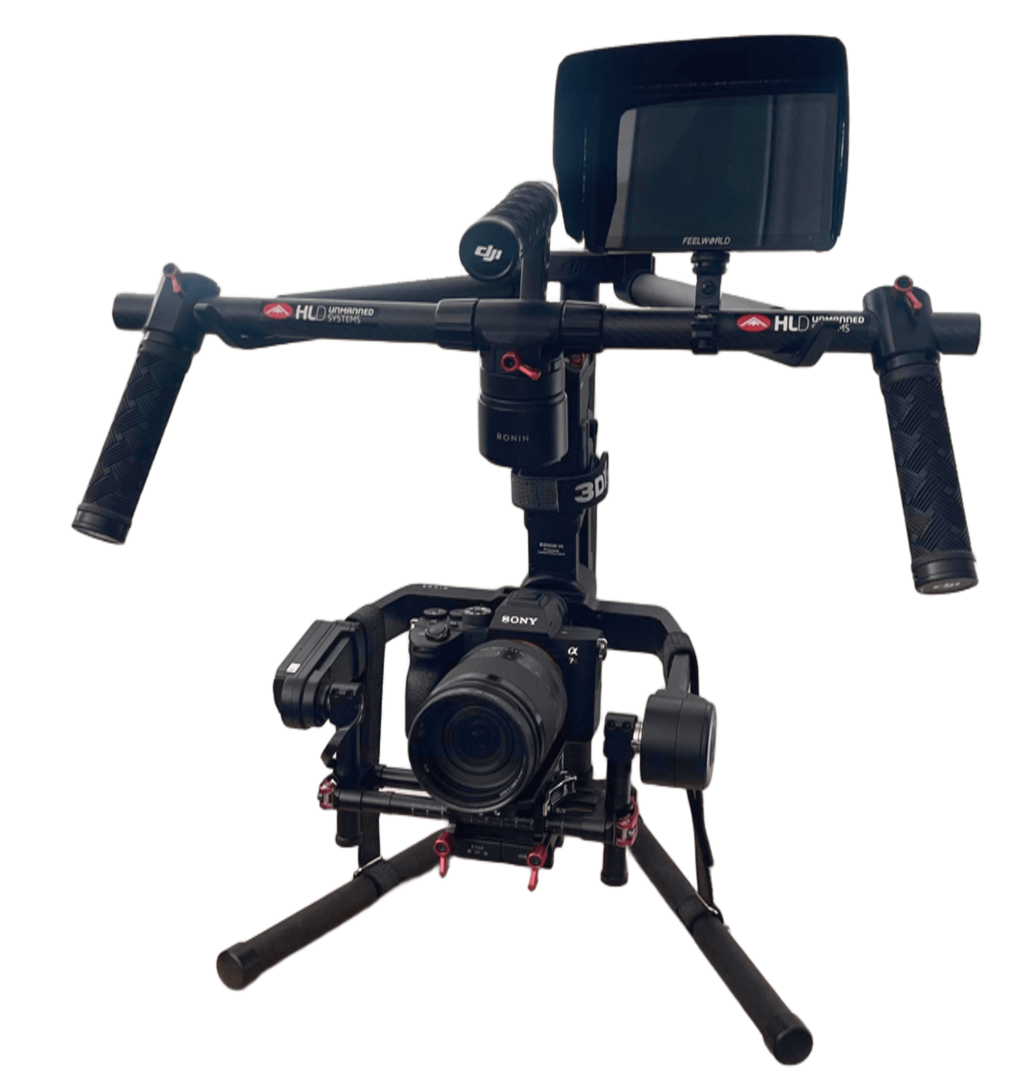
In HLDUS we are specialized in the handling of drones and other unmanned vehicles, although we also have tools for taking pictures and videos at ground level. For example, our Sony Alpha 7R integrated in a Ronin-M stabilizer, which allows us to record stabilized shots.

On the other hand, we also have other handheld gimbals for other more compact cameras such as the Sony RX0, RX 100 or even action cameras like GoPro for informal handheld recording, but guaranteeing image stabilization with mechanical 3-axis gimbals.

In summary, High Line Division Unmanned Systems is not just another drone service provider, but we also have the know-how and experience to find the right technical solution for any mission. Contact us for assessment regarding the most suitable technical solution for your needs.

Are you interested in our solutions?
Download our Brochure Contact Us